


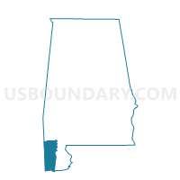
St. Andrews Episcopal Church, Mobile County, Alabama
About
Outline

Summary
| Unique Area Identifier | 522597 |
| Name | St. Andrews Episcopal Church |
| County | Mobile County |
| State | Alabama |
| Area (square miles) | 5.48 |
| Land Area (square miles) | 3.75 |
| Water Area (square miles) | 1.72 |
| % of Land Area | 68.57 |
| % of Water Area | 31.43 |
| Latitude of the Internal Point | 30.58638280 |
| Longtitude of the Internal Point | -88.08711580 |
Maps


Graphs
Select a template below for downloading or customizing gragh for St. Andrews Episcopal Church, Mobile County, Alabama


Neighbors
Neighoring Voting District (by Name) Neighboring Voting District on the Map
- Elk's Lodge #108, Mobile County, AL
- First Independent Methodist, Mobile County, AL
- Hollingers Island School, Mobile County, AL
- Riverside Church of the Nazarene, Mobile County, AL
Top 10 Neighboring County Subdivision (by Population) Neighboring County Subdivision on the Map
Top 10 Neighboring Place (by Population) Neighboring Place on the Map
Top 10 Neighboring Unified School District (by Population) Neighboring Unified School District on the Map
Top 10 Neighboring State Legislative District Lower Chamber (by Population) Neighboring State Legislative District Lower Chamber on the Map
- State House District 104, AL (47,450)
- State House District 105, AL (44,279)
- State House District 103, AL (40,611)
- State House District 97, AL (35,406)
Top 10 Neighboring State Legislative District Upper Chamber (by Population) Neighboring State Legislative District Upper Chamber on the Map
Top 10 Neighboring 111th Congressional District (by Population) Neighboring 111th Congressional District on the Map
Top 10 Neighboring Census Tract (by Population) Neighboring Census Tract on the Map
- Census Tract 70, Mobile County, AL (4,559)
- Census Tract 74, Mobile County, AL (3,647)
- Census Tract 19.02, Mobile County, AL (3,418)
- Census Tract 18, Mobile County, AL (2,634)
- Census Tract 19.01, Mobile County, AL (2,254)
- Census Tract 20, Mobile County, AL (1,819)
- Census Tract 9900, Mobile County, AL (0)